Site Plan Export 2.0
We’ve completely rebuilt PDF exports in Pyro Plot to better match how firework site plans are actually used in the real world — especially for permit applications and working with AHJs.
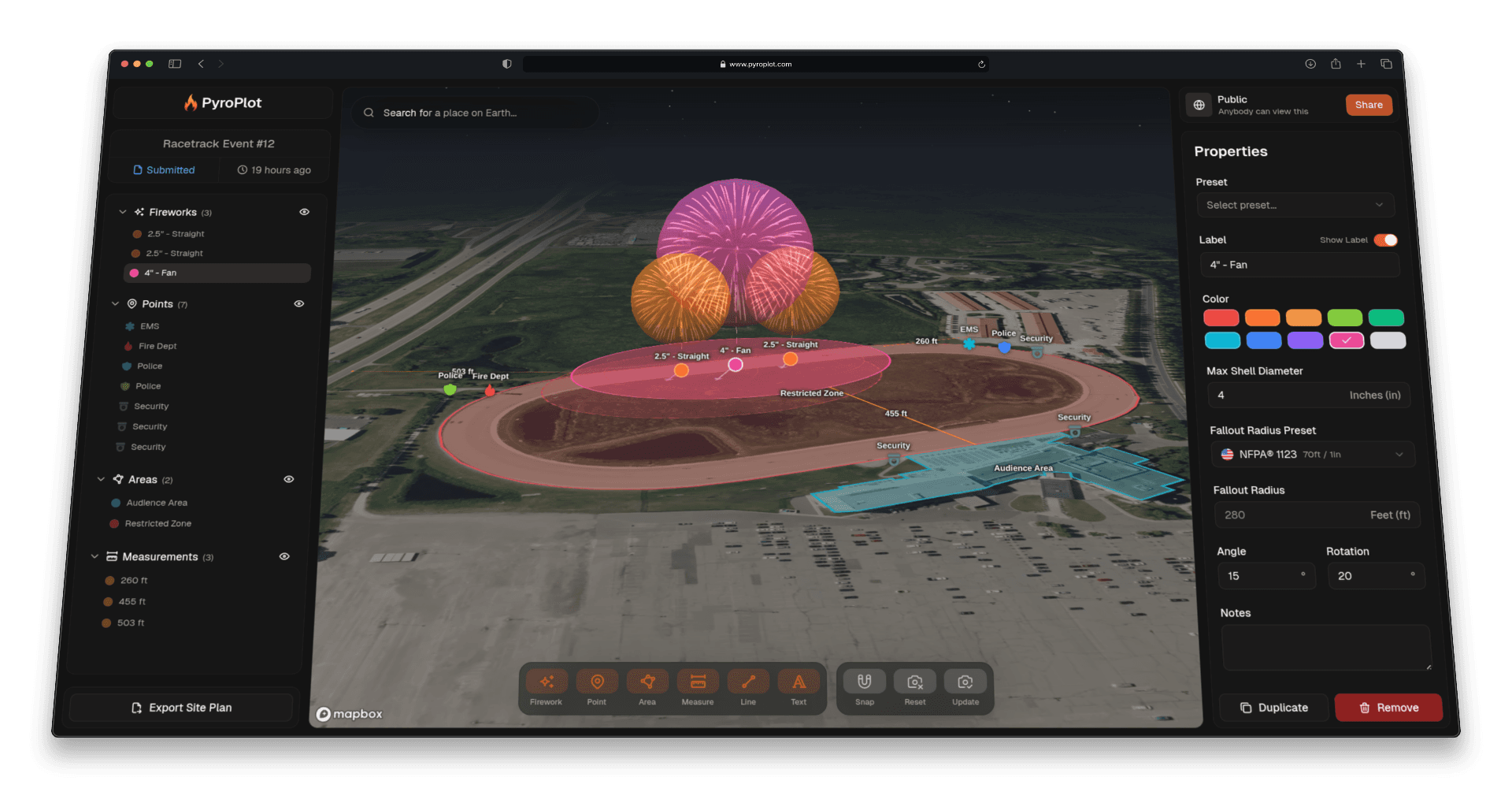
The biggest change is control.
Exports now include built-in essentials like a compass and scale, so your maps clearly communicate orientation and distance without needing any extra work outside the platform. This makes your site plans more aligned with NFPA 1123 expectations and easier for authorities to review and approve.
You can also now add your company logo directly onto your maps, not just the cover page. It’s a small change, but it makes your documentation feel much more professional when you’re sending site plans to clients, venues, or regulators.
The most impactful addition is multiple map views.
Instead of trying to fit everything into a single map, you can now include different views of the same firework site plan in one export. For example, you might have:
- An overview of the entire display
- A closer view of the launch area
- A focused map showing fallout zones or spectator areas
This is especially useful for larger or more complex shows where clarity matters, and where a single map just isn’t enough.
On top of that, we’ve cleaned up how everything is presented. Annotations, crew members, and notes are now more structured and easier to read, resulting in exports that feel polished and ready to send.
Overall, Site Plan Export 2.0 is about turning your work in Pyro Plot — from site plan mapping to fallout zone calculation — into clear, professional documents that help you move faster through the permit approval process.